|
Joplin
|
|
[HOME] [WESTERN AMERICANA GALLERY] [ROUTE 66 HOME] [ROUTE 66 WEST] [ROUTE 66 EAST]
|
Joplin
|
|
Webb City |
||
|
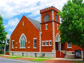
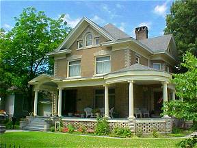
Joplin, Missouri, just west of Webb City was a major town dependent on the lead and zinc mining industry and the railroad. Where Joplin was a miner's town Webb City was a mine owner's town. There was money here during the boom days. The beautiful homes and churches along Route 66 here attest to that fact. Webb City was the site of the first major discovery of lead in the region. John Webb, a farmer, uncovered a chunk of pure lead and the boom was on! Originally the town was platted in 1875 and was a major lead and zinc producer until the end of W.W. II. | |
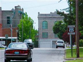
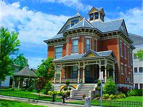
| If you enjoy searching out beautiful Victorian architecture and quiet historic neighborhoods then a stroll down any one of Webb City’s historic streets will delight you. During Jack Rittenhouse’s journeys along the Mother Road he describes Webb City as a small manufacturing center with no major tourist accommodations. |
|
|
|
|
|
| Beautiful Victorian homes attest to the time when Webb City was one of the richest cities in America. | ||
| Joplin, Missouri gateway to the West | ||
| Joplin really got going from the lead mines that supported it, though it was a settlement on the Santa Fe Trail long before lead was discovered here in 1850. John C. Cox originally settled Joplin in 1838 as a trading post along the banks of Turkey Creek. He named the settlement Blytheville in 1841 after a Cherokee Indian. In 1871 John Cox platted the city of Joplin on the east side of Joplin Creek at the same time Patrick Murphy of Carthage platted the town of Murphysburg on the west side of the creek. A fierce rivalry sprang up between the two towns. Before this rivalry could erupt in violence, the Missouri State General Assembly combined the two towns that had sprung up along Joplin Creek into the City of Joplin thus ending the rivalry in 1873. Joplin was a rough and wild town back in the old mining days and catered to all that a lonely miner might want - for a fee of course. Back in the wild old days Joplin’s Main Street was lined with saloons, dance halls and gambling establishments. Today the mine tunnels under the streets of Joplin have yielded their last ore and are now filled with water to supply the thirsty town above. By the time Route 66 came through it had settled down somewhat and catered to all that a traveler might need - for a fee of course. Joplin was also the last chance for the westbound traveler to soak up some suds, as Kansas was "dry." | ||
| Schifferdecker Park was here before Route 66. It was started in 1909 and was known as Electric Park back then. In 1922 the golf course opened here, and after Route 66 came through it was a popular stopping off place for the traveler. Today the park offers a nice resting area for the road weary traveler much like it did in the days of Route 66. There is also a fine museum in the park with exhibits on the Joplin area, the mining days complete with an impressive mineral collection, and of course Route 66 exhibits. | 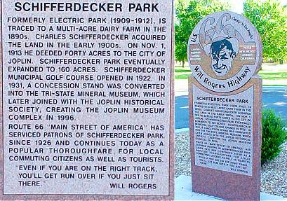 |
|
 |
There's a lot to see on Joplin's Route 66. Old Route 66 goes through the historic downtown district of Joplin. The saloons, dance halls and theaters are now closed but the Route 66 explorer will see many fine examples of 19th Century architecture that takes one back to those old days of the mining boom. | |
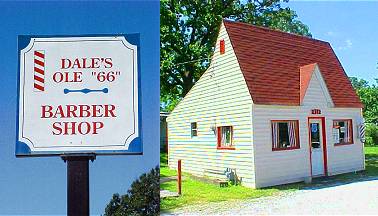
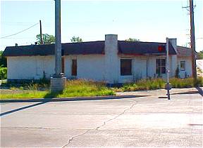
| If you were to drive Route 66 in east Joplin you would find that the road meanders through quiet historic neighborhoods. In one such neighborhood an old Phillip’s Cottage Style station is still evident, a throwback to the days when this now quiet road was alive with a nation on the move. This old Phillips Cottage Style Filling Station at Utica and Euclid was converted into Dale's Ole 66 BarberShop. Dale has been in business here for decades. He just retired June 2003! |
|
|
Photographs taken June 2003
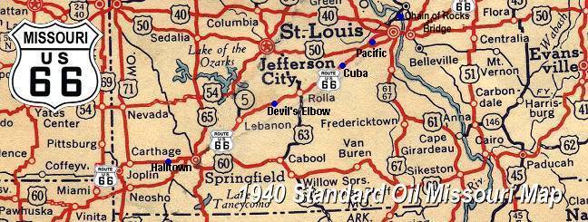
Click on an area or city of Route 66 on the map below to take a cyber tour of that section of the Mother Road |
|
|
NAVIGATION NOTE: Buckle up and hold on to your mouse! These pages are arranged like the map above, from the western state border to the eastern state border. I have set up this site as if you were traveling from EAST to WEST, much like the Joad family in The Grapes of Wrath. You can click on the Route 66 shields to "travel" the Mother Road in either direction though. Or you can select any shield below to take you to that specific state. |
|
Kansas Route 66 |
To Historic
|
© Copyright 2003 GRandall Web Design Service